top_triangle28x18

Historic Lewes Byway Management

Delaware Greenways’ stewardship of the Historic Lewes Byway, Gateway to the Bayshore is a commitment to the projects and programs outlined in comprehensive management plans.  As the route’s guiding principles, these plans provide a framework for:

  • Preservation of its natural resources and historic quality.
  • Expanding tourism through promotion of the byway’s intrinsic resources.
  • Positively impacting economic growth.

County:           Sussex
Length:           13.1
Drive Time:    About 1 hour

Guiding Principles

Delaware Greenways stewardship of the Historic Lewes Byway, Gateway to the Bayshore is a commitment to the projects and programs outlined in the Corridor Management Plan (CMP), Kings Highway & Gills Neck Road, and, New Road Master Plans.

As the routes guiding principles, these plans set the framework for preservation of its natural resources and historic quality.  As these intrinsic resources are preserved, we’re expanding tourism, and positively impacting economic growth.  We’re working hard to provide a better quality of life for the residents and visitors of Lewes.

Managing the Byway

The Byway Management Committee, and its subcommittees are collaborative efforts involving dedicated citizens from the Greater Lewes community, City and County staff, and State agency representatives.  Chaired by Mary Roth, Executive Director of Delaware Greenways, the Committee coordinates directly with the Byway Management Committee of the Delaware Bayshore Byway. 

The Committee is actively seeking interested individuals to serve on its management and subcommittee. Contact Mary Roth at mroth@delawaregreenways.org.

Management Committee Chair
  • Mary Roth
    Executive Director,
    Delaware Greenways 

US 9 (Kings Highway) from SR 1 to Freeman Highway In-Person Public Workshop Held:

On February 20, 2024, the Delaware Dept. of Transportation (DelDOT) held a public workshop to provide details, including proposed intersection improvements for a mile-plus stretch of Kings Highway, one of the Historic Lewes Byway roadways.

DEADLINE 3/22/24: DelDOT is seeking public input on the proposed updates to traffic operation and capacity, multimodal facilities, and the integration of recommended  local initiatives. You’ll find workshop materials and related information on DelDOT’s project page.

Interested persons are invited to express their views in writing, giving reasons for support of, or opposition to, the proposed project.

Comments can be mailed to DELDOT Community Relations, P.O. Box 778, Dover, DE 19903 or sent via email to dotpr@delaware.gov. The deadline for comments is Friday, March 22, 2024.

Read the HLB Management Committee’s recommendation in Mary Roth’s Letter to the Editor.

Historic Lewes Byway Committee supports Kings Highway plan | Cape Gazette 2/16/24

Planning Initiative Spotlight: SAVANNAH ROAD MASTER PLAN

The Delaware Department of Transportation (DelDOT) in partnership with Delaware Greenways and the Historic Lewes Byway is conducting a project to draft a master plan for Savannah Road in and around Lewes in Sussex County. The study will look at current and future needs along Savannah Road and create a future vision for the corridor that aims to enhance the experience of all road users while maintaining the unique and valued character of this important part of the Lewes Byway. This is the last master plan needed for each major corridor of the Historic Lewes Byway before DelDOT addresses Five Points intersection. The master plan will be used to inform and guide decision-making regarding land use and development while identifying improvements for funding consideration.


Project Study Area

The project study area is approximately 3.25 miles in length and runs from Five Points in the west to the Lewes Beach in the east. Savannah Road is a two-lane undivided road with a posted speed limit of between 25 and 35 mph. Along its length, Savannah Road exhibits a range of characteristics including seaside beach, downtown, and suburban settings. A portion of the road is contained within the City of Lewes and the remainder in unincorporated Sussex County.

THE SAVANNAH ROAD MASTER PLAN INCLUDES SHORT, MID AND LONG-TERM IMPROVEMENT CONCEPTS FOR:
  • Pedestrian Facilities
  • Bicyclist Facilities
  • Traffic Facilities
  • Sense of Community & Character


READ THE MASTER PLAN STUDY TO LEARN MORE.


Planning Initiatives

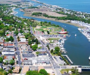
The Management Committee works to ensure that the intrinsic qualities of this southern Delaware byway, are preserved, encouraging tourism and economic growth.

The Five Points Transportation Study (the Study) has been a joint effort, developed by DelDOT and Sussex County, to examine potential improvements to the area around the Five Points intersection near Lewes. Learn more about the study, project timeline, and view documents, on DelDOT’S project page

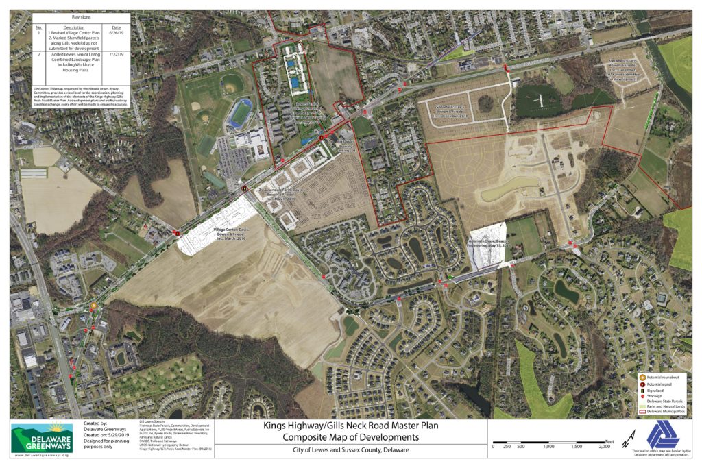
Ten years ago the Kings Highway and Gills Neck Corridors were inundated with major development proposals:

  • Traffic studies called for Kings Highway to be widened to a multi-lane highway and Gills Neck Road to be widened to include shoulders.
  • Many of the development proposals lay dormant until 2015.

Simultaneously, the Historic Lewes Byway Committee completed the Corridor Management Plan for Kings Highway and Gills Neck Road:

  • The plan recommended Kings Highway be a landscaped boulevard and serve as a gateway into Lewes, to the Cape May Lewes Ferry and to Cape Henlopen State Park.
  • Gills Neck Road would highlight the remaining historic landscapes.

Yet the CMP recognized the impending development and recommended that the style of the development in the corridor reflect character of Lewes and be walkable and bikeable.

  • It called for a more urban design of Kings Highway: two lanes in each direction with a landscaped median and landscaped roadsides.
  • For Gills Neck Road, it called for landscaped roadside with a short segment of a landscaped median near Kings Highway.
  • The Kings Highway/Gills Neck Road Master Plan laid out in more detail what the CMP envisioned for the Corridors.
  • The Composite Map project helps illustrate the Corridor Management Plan map. (view composite map at right)
  • Parts of the Master Plan that are not constructed by developers will be constructed by DelDOT under a capital project, the initial design stages are slated to begin in 2022.

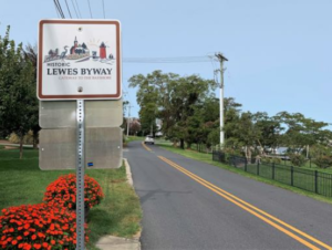
The byway is currently marked via logo signage to clearly indicate the Historic Byway designation.
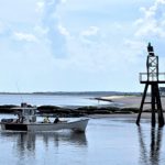
Stay tuned for more information.

Stay tuned for more information.

Stay tuned for more information.

Composite Map of Kings Highway and Gills Neck Road

Download the map
  • The composite map of Kings Highway and Gills Neck Road is designed to be ‘living’ and continually updated.
  • It supports the work of the Historic Lewes Byway Committee as it implements the Corridor Management Plan, the Kings Highway and Gills Neck Road Master Plan, and becomes an important asset for the Committee’s Design Guidelines team in their work with developers and property owners.
  • We envision the map benefitting DelDOT’s subdivision engineers as they work to tailor transportation improvements to the Master Plan, and an asset to Sussex County and the City of Lewes in their land development management process.
  • The map looks at the numerous development projects in various stages of the land development process along Kings Highway and Gills Neck Road, some of which were accounted for in the Kings Highway and Gills Neck Road Master Plan but all of which are different in some aspect and see how they fit individually and together into the Master Plan. 

Download Historic Lewes Byway Planning Documents

2019 New Road Corridor Master Plan

Download .PDF

2016 Kings Highway and Gills Neck Road Master Plan

Download .PDF

2015 Lewes Byway Corridor Management Plan

Download .PDF

Stay connected to Historic Lewes Byway news.

Interested in Exploring Now?

The Historic Lewes Byway is
open and ready for adventure!

Historic Lewes Byway Partners

This website uses cookies to ensure you get the best experience on our website.