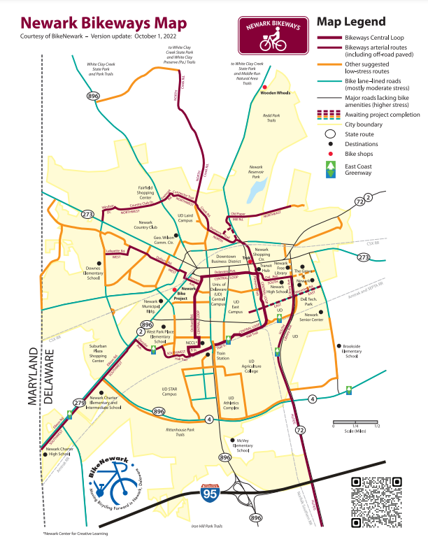
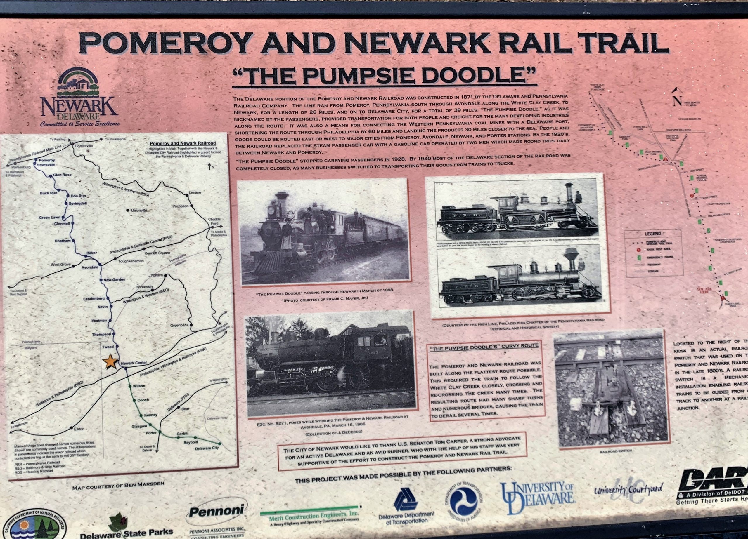
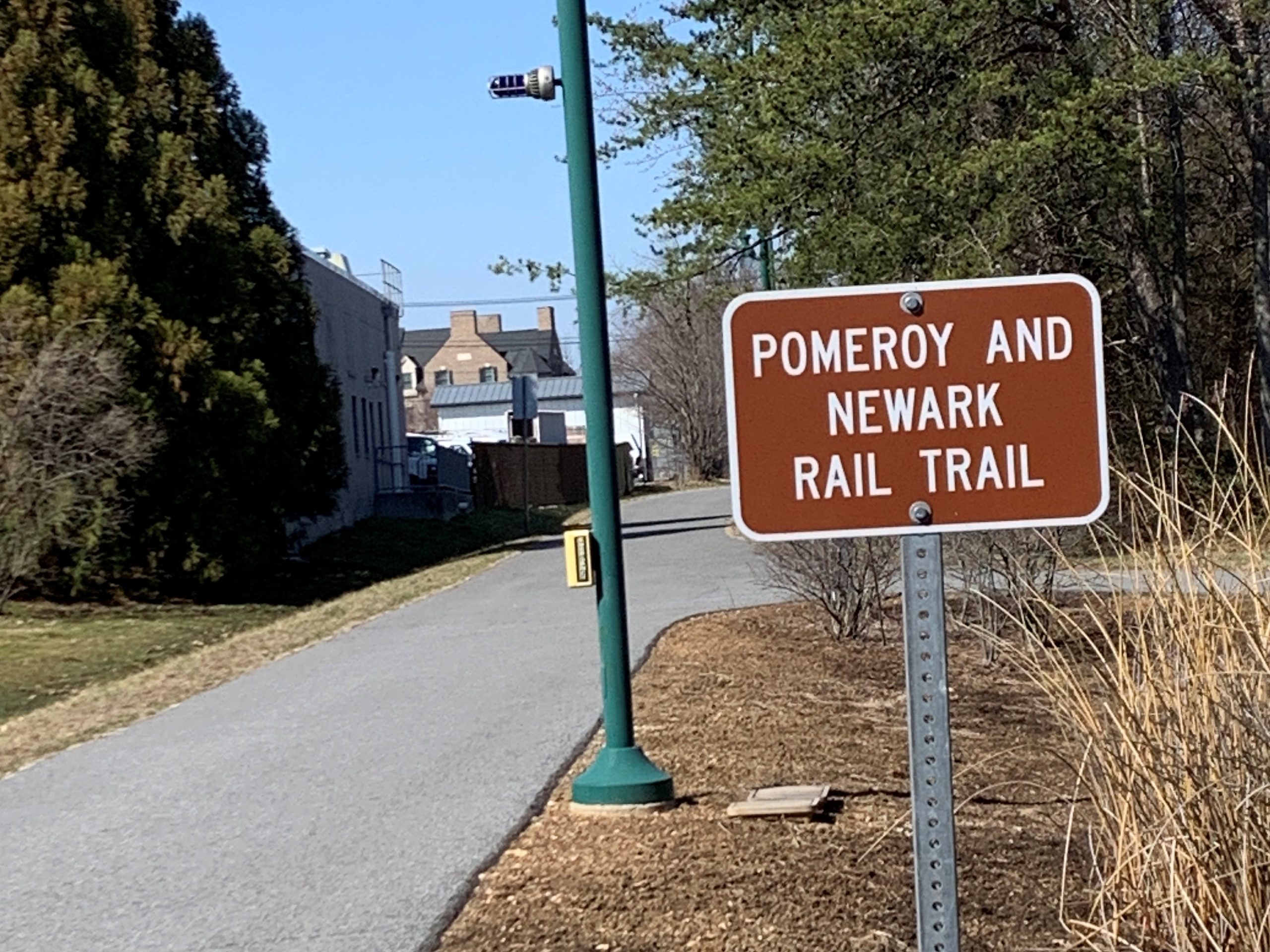
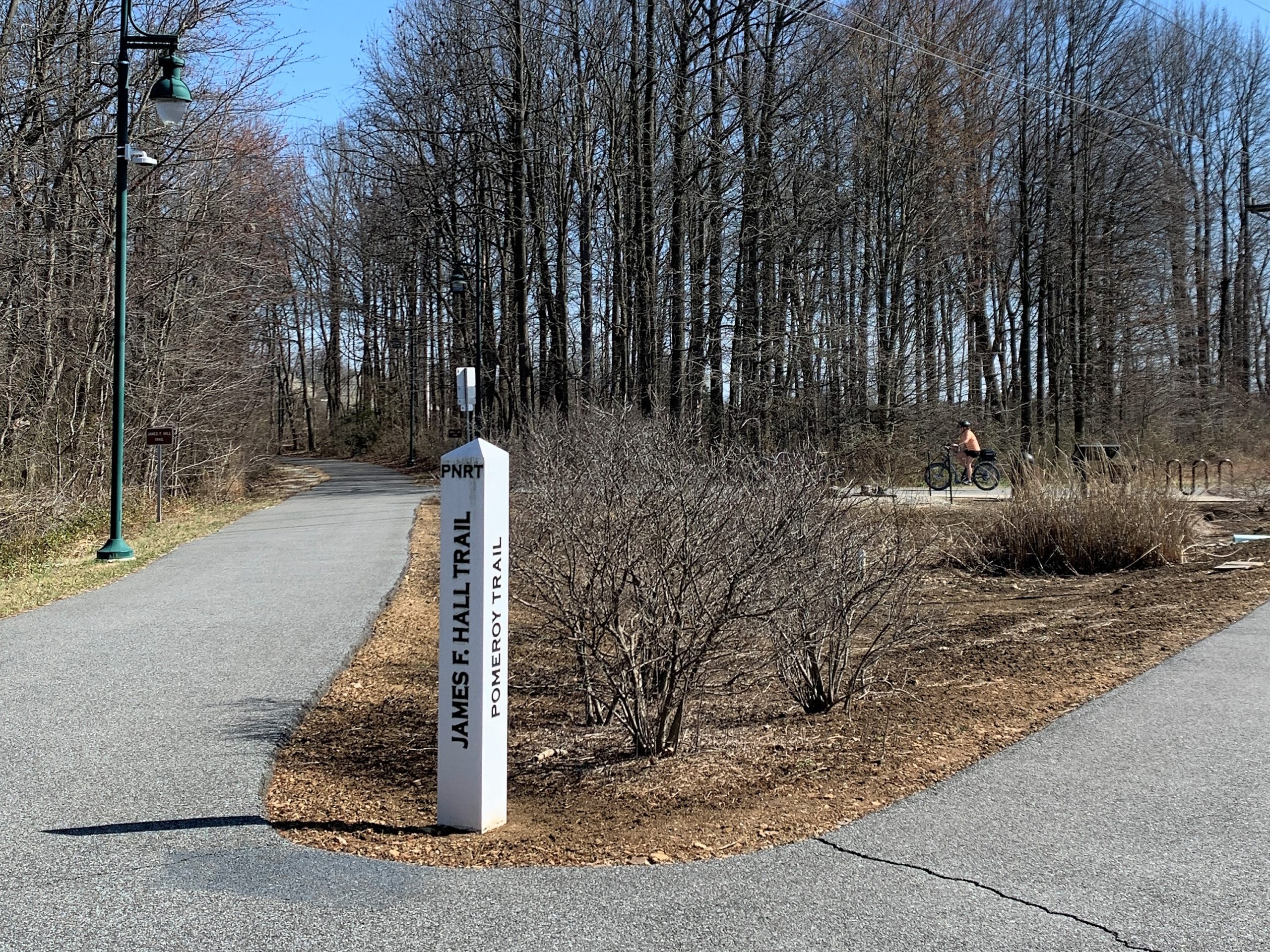
The Pomeroy Trail is an urban trail that eventually blends into the natural setting of White Clay Creek State Park. Portions run along White Clay Creek, a designated National Wild & Scenic River.
A fully paved, accessible, and lighted pathway that is open year round. The trail includes three information kiosks to inform the public of the rail line’s history.
The trail, a segment of the Newark Bikeways‘ Central Loop, and the north section, runs north-south starting in White Clay Creek State Park at Hopkins Road and ends when it connects to the James F. Hall Trail, which runs east-west in Newark.